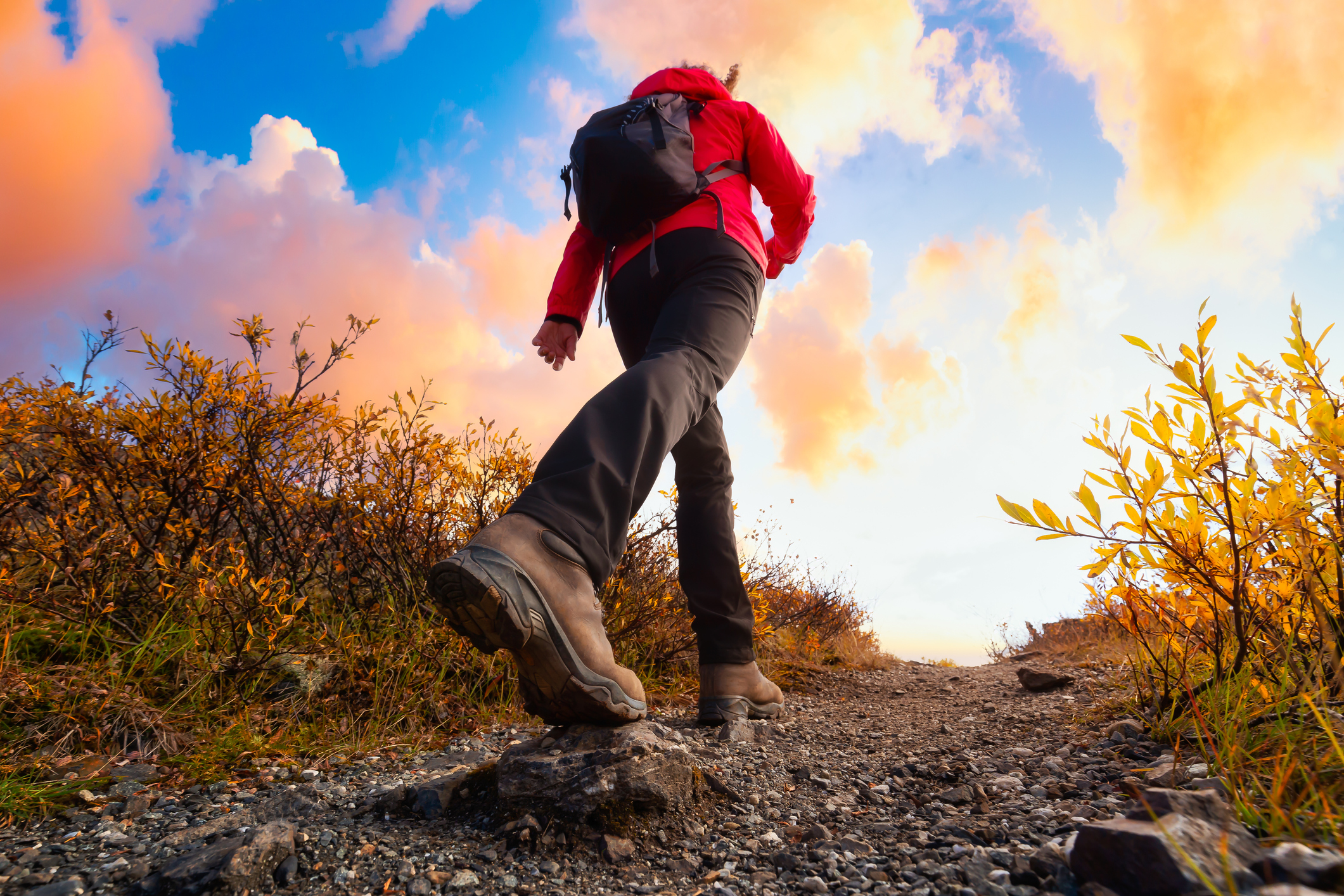
HIKE IT
Fall is an amazing time to get outdoors in Western Maryland, and so, dear reader, we’ve compiled a list of the best hiking spots in the region for you to venture out on, whether the weather is warm and sunny or even cold and a bit forbidding
You’re a seasoned hiker introducing your non-hiker friends to hiking
Cunningham Falls Nature Loop (Thurmont)
If you’re looking for a gateway hike for novices, look no further than the Cunningham Falls Nature Loop, a 5.5-mile hike just outside of Thurmont. This moderate hike includes Cunningham Falls, the largest waterfall in Maryland, as well as some phenomenal elevated views; however, this trail is typically very busy and dogs are not allowed.
An additional perk of this hike is that you can rest and reward yourself with a bottle of wine from a nearby winery, Catoctin Breeze Vineyard (catoctinbreeze.com).
Pros: Good for new hikers, beautiful mountain and waterfall scenery, well-maintained trail
Cons: Heavily trafficked, limited parking, no dogs.
You’re a newer hiker, a dog owner, or an Instagram influencer:
Weverton Cliffs (Knoxville)
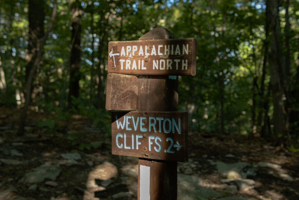
Weverton Cliffs is, in this writer’s opinion, one of the best hiking spots in Maryland. This hike is a short 2 miles out-and-back trail with some phenomenal views of the Potomac. This hike is also dog-friendly, which is great news if you have a dog or if you want to see lots of other people’s dogs. If you get to the top and find yourself wanting more of a challenge, this trail also connects to the Appalachian Trail, so you can add plenty more mileage if you so desire. I enjoy taking my pup, Chester, and in turn, he enjoys scaring his mother by sniffing too close to the edge of the cliffs.
This hike is heavily trafficked and parking is limited, so if you do venture out, I would recommend hitting this trail early. This also helps you budget for plenty of time to drive across Jefferson Pike for a well deserved brunch at one of my favorite local coffee places, Beans in the Belfry, in Brunswick.
Pros: Beautiful mountain and river scenery, adjustable hike distance, dog-friendly
Cons: Heavily trafficked, limited parking, summit can get congested
You enjoy pain and suffering Appalachian Trail section hike:
Wolfsville Road to Raven Rock (Smithsburg)

This is a true and embarrassing story. I moved to Maryland and met a new friend, Becca, who invited me on a hike with an acquaintance she met on the internet. I, new to the area and hoping to meet new friends, agreed to go on said hike. The morning of the hike, my alarm does not go off. I get a call from my new friend asking me where I am, to which I lie and respond with “I’m on my way” (I was still in bed). After racing out the door wearing what I was wearing and nearly forgetting a bottle of water, I sped out to meet the group of women. To this day, I will never live down my now-close friends not believing me (with good reason) when I say “I’m on the way.”
The moral of this story is that this is not a hike that you want to be ill-prepared for. You want water. You want snacks. You want comfortable shoes that fit (Becca still has a bruise on her toe from that hike. We can literally measure the length of our friendship by her toenail growth).
Riley, our mountaineer, brought a tourniquet and toilet paper. While you might not need one of those, this hike is not one that you want to mess around on. It is grueling and slippery. Notably, depending on the time of year, you may encounter some flooding on the southside of Raven Rock Road. This hike is notorious as being one of the most difficult AT sections in Maryland. While dogs are allowed on this trail, you may want to consider the ability of your dog before setting out. This trail also features myriad types of terrain, including fields, some rock scrambling, small stream crossings, and rigorous elevation gain.
While AllTrails notes this trail is about 9.6 miles, our watches indicated this out-and-back hike was actually closer to about 11 miles. At the end of the section, you’ll be greeted by Raven Rock shelter to snack and rehydrate. Or, if you’re ill-prepared as I was, you can watch your friends snack and maybe even beg them for some toilet paper.
Pros: Few hikers, myriad types of terrain, challenging for more experienced hikers, dog-friendly
Cons: Remote, limited parking at the Appalachian Trail trailhead
You want to get away from the crowds:
High Rock Trail (Grantsville)
At risk of stating the obvious, as a lifelong Michigander new to Maryland, I was shocked at how many people live out here. If you’re looking to escape the crowds, one of the more remote Maryland hikes is a short 2 miles out-and-back trail. The summit of this trail is the highest point in Savage River State Forest featuring some beautiful sunset vistas and a rock scramble. If you’re planning on hiking this trail, I would recommend downloading a trail map, directions, or topography before setting out on your hike, as cell service may be limited.
At risk of stating the obvious, as a lifelong Michigander new to Maryland, I was shocked at how many people live out here. If you’re looking to escape the crowds, one of the more remote Maryland hikes is a short 2 miles out-and-back trail. The summit of this trail is the highest point in Savage River State Forest featuring some beautiful sunset vistas and a rock scramble. If you’re planning on hiking this trail, I would recommend downloading a trail map, directions, or topography before setting out on your hike, as cell service may be limited.
Pros: Few hikers, well-maintained trail, mountain views, rock scramble
Cons: Remote, trailhead can be difficult to find, limited cell service.
Happy trails!
By: Chelsea Mongeau